
What does a car-free commute from Highland take?
A car-free commute from Centro takes four checks: the distance, the nearest stop, the route at your hour, and one test ride. The first two checks use measured numbers from this page. The last two you must do yourself, because schedules change and one query is not a promise.
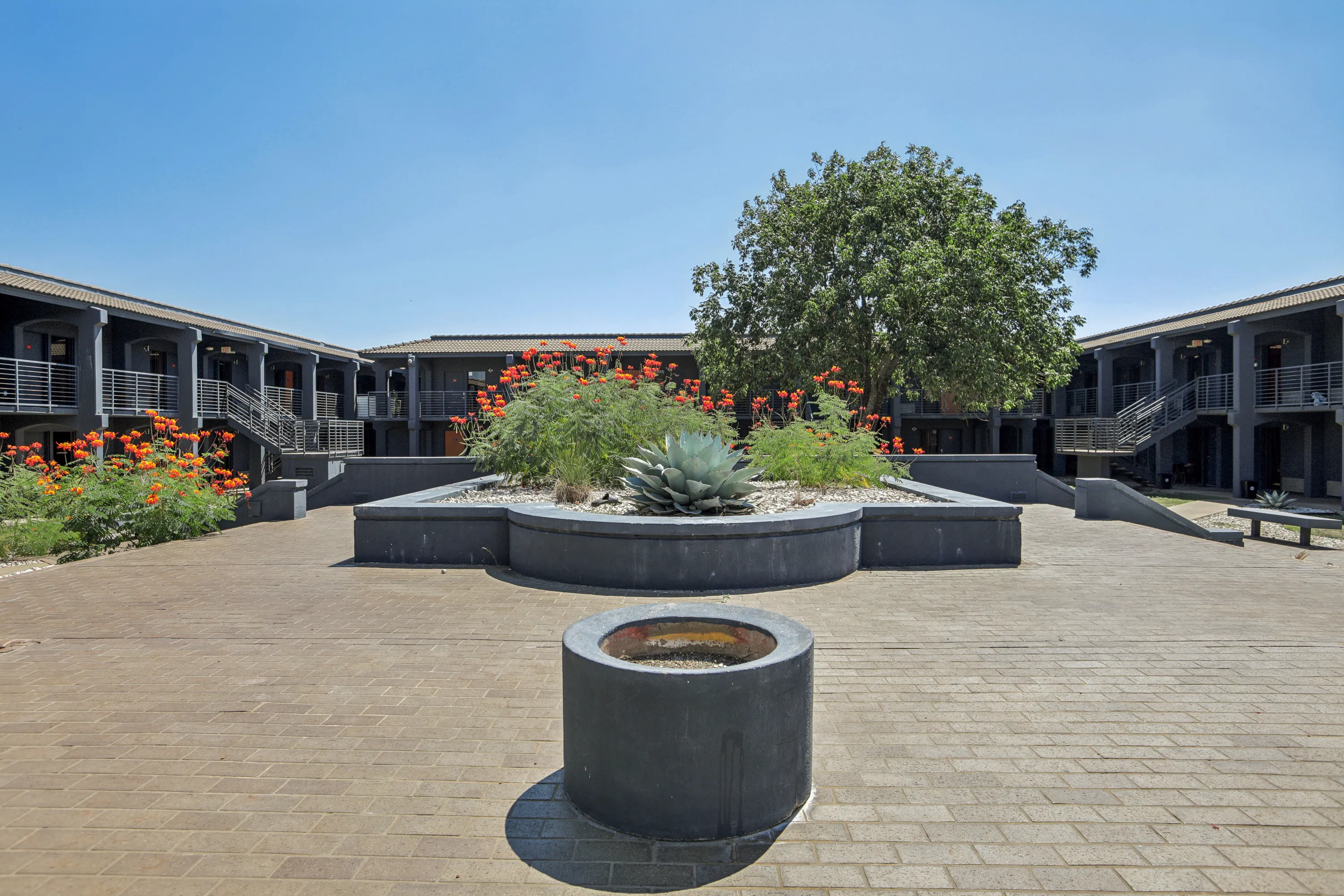
Centro Studio Homes is at 824 Camino La Costa, Austin, TX 78752. Its bus stops are 341 to 501 meters away in a straight line. Highland Station on the Red Line is 0.70 miles away. Centro lists bike storage and Echelon bikes among its amenities. The car-light living glossary entry defines the idea, and our getting around Highland pillar page gives the full route list.
How do you plan the commute, step by step?
Follow five steps in order. Each one narrows the options before you spend time on a test ride. The whole process takes about an hour at a desk and one trip on the ground.
- Write down the destination and the hour. Name the address and the time you must arrive. A 9 am class and a 9 pm shift face different bus service.
- Look up the distance. Open the Highland commute table. Read the straight-line and road distances. Note which have bike or transit figures and which say “not measured.”
- Find the nearest stop. The stops near Centro are listed below. Pick the one that sits on your route.
- Run CapMetro’s trip planner. Enter Centro’s address and your destination for your real arrival time. Use the planner’s times, not ours, for daily planning.
- Ride it once. Do the trip on a weekday at your real hour before you sign a lease. Note the walk to the stop, the wait, the transfer and the walk at the end.
Which stops and stations are near Centro?
Four bus stops and two rail stations sit within about 1.8 kilometers of the address in a straight line. The table lists the ones we measured, with the routes that Google Maps data showed boarding there on 2026-11-02.
| Stop or station | Straight line from Centro | Routes shown or listed | Basis |
|---|---|---|---|
| 1016 Camino La Costa/La Posada | 341 m | 337 | OpenStreetMap stop; Google Maps transit data |
| 1017 Camino La Costa/La Posada | 501 m | 337 | OpenStreetMap stop; Google Maps transit data |
| 900 St Johns/Bennett | 406 m | 300 | OpenStreetMap stop; Google Maps transit data |
| 801 St Johns/Bennett | 432 m | 300 | OpenStreetMap stop; Google Maps transit data |
| Highland Station (Red Line) | 1,120 m (0.70 miles) | 550 rail; buses 7, 324, 337, 350 list it | OpenStreetMap; CapMetro; Wikipedia |
| Crestview Station (Red Line) | 1,774 m (1.10 miles) | 550 rail; route 7 begins nearby | OpenStreetMap; CapMetro |
The walk to the first Camino La Costa/La Posada stop is about 0.3 miles and about 7 minutes by Google’s steps. Stops on Roland Johnson near Huntland are 286 and 299 meters away, but we did not read which routes use them.
How do you get to Highland Station and the Red Line?
You have three choices: walk, ride a bus, or bike. Highland Station is at Airport Boulevard and Highland Mall Boulevard, directly across from the old Highland Mall site. CapMetro’s route 550, the Red Line, has 10 stations from Downtown to Leander, including Highland (ACC).
Walking is about 1.3 miles and 28 to 33 minutes by Google Maps data. The straight line is 0.70 miles, and the longer walk goes around the I-35 frontage road. Routes 7, 324, 337 and 350 list Highland Station as a destination in CapMetro schedules effective August 16, 2026 to January 9, 2027. Route 337 boards on Camino La Costa per Google Maps data. We did not verify the start points of the other three. Bike time to the station is not measured. We did not read the Red Line frequency from the route 550 timetable, so look it up before you plan around a train. Our Metrorail Red Line glossary entry and Highland Station entry define each term.
How do you get to ACC Highland without a car?
ACC Highland is 0.61 miles from Centro in a straight line, but the walking route is 1.2 miles and 26 to 28 minutes by Google Maps data. The route goes around the I-35 frontage road, which is why it is twice the straight-line figure. A drive is about 1.2 miles and 3 minutes by an OSRM estimate without traffic.
Four routes list ACC Highland as a destination: 7, 324, 337 and 350. ACC Highland is a campus of Austin Community College at 6101 Highland Campus Dr. See apartments near ACC Highland for campus facts, and the ACC Highland glossary entry for a definition. Our post on getting to ACC Highland from Centro covers the options in more detail.
How do you get to UT Austin and Downtown without a car?
Transit to UT takes 48 to 56 minutes in the data we have, and a bike ride takes 20 to 25. The UT campus is 3.58 miles from Centro in a straight line. Google Maps data from 2026-11-02, about 9 pm, showed two transit options, each with one transfer.
| Mode to UT Austin | Distance | Time | Basis |
|---|---|---|---|
| Transit: route 337 plus route 320 | 9.4 miles | 48 min | Google Maps data, 2026-11-02, about 9 pm |
| Transit: route 337 plus route 1 | 6.6 miles | 56 min | Google Maps data, 2026-11-02, about 9 pm |
| Bike | 3.9 to 4.9 miles | 20 to 25 min | Google Maps data, 2026-11-02 |
| Drive | 5.0 miles | about 11 min | OSRM estimate, no traffic |
We did not measure daytime transit times, and we did not measure the Downtown transit time. Downtown (1100 Congress Ave) is 4.21 miles in a straight line and 5.4 miles by road, about 9 minutes without traffic. Read apartments near UT Austin and Downtown and our post on Highland to Downtown without a car for more.
What is the bike route near Centro?
Mapped bike lanes start at the door. OpenStreetMap tags Camino La Costa with a bike lane, and E St Johns Ave and Cameron Rd with cycle tracks. Airport Blvd has a track, a lane or a separate cycleway in places, and the Red Line Trail is mapped as concrete cycleway segments near Highland and Crestview stations.
OpenStreetMap can lag the street. A “track” on the map may not be a protected lane on the ground. Ride the route in daylight and check the surface, the crossings and the places where the lane ends. Google Maps data gave 3.9 to 4.9 miles and 20 to 25 minutes to UT by way of Camino La Costa and Duval St or Red River St. Centro lists bike storage on property. Ask the leasing office how it works.
Which trips are hard without a car?
Trips without a measured transit time need a plan. The Domain is 5.12 miles from Centro in a straight line and 6.1 miles by road, about 11 minutes without traffic. We did not verify a Red Line path from Highland Station to The Domain, and we did not measure the transit time.
Austin-Bergstrom airport is 8.54 miles in a straight line. OSRM gives 12.8 miles and about 16 minutes by road. Apartments.com gives 16.7 miles and 26 minutes. We did not measure a transit time to the airport. Mueller is 2.18 miles away in a straight line, and we did not confirm a bus or rail path, so see apartments near Mueller. Read the Highland to Mueller routes post and the The Domain page for the facts we do have.
| Trip | Straight line | Road estimate | Transit time |
|---|---|---|---|
| Mueller (Thinkery) | 2.18 miles | 3.3 miles, about 6 min | not measured |
| The Domain | 5.12 miles | 6.1 miles, about 11 min | not measured |
| Austin-Bergstrom airport | 8.54 miles | 12.8 miles, about 16 min (OSRM) | not measured |
| Dell Children’s Medical Center | 1.94 miles | 2.9 miles, about 6 min | not measured |
Road estimates are OSRM free-flow figures with no traffic. We make no claim about care or quality at any hospital.
How do you choose between bus, rail and bike for each trip?
Match the mode to the distance and to what you measured. Use the table as a starting point, then confirm each row in the CapMetro trip planner.
| Trip | Option with a measured basis | Option with no measured basis |
|---|---|---|
| Highland Station | Walk 1.3 miles, 28 to 33 min (Google Maps data) | Bike time, bus wait |
| ACC Highland | Walk 1.2 miles, 26 to 28 min (Google Maps data) | Bike time, bus wait |
| Crestview Station | Route 300 ride, 6 min from the St Johns/Bennett stop (Google Maps data) | Walk and bike time |
| UT Austin | Bike 20 to 25 min; transit 48 to 56 min (Google Maps data) | Daytime transit |
| Downtown | Straight line 4.21 miles, road 5.4 miles | Transit and bike time |
Where the right column has an entry, you have homework: run the planner, or ride it yourself. Do not assume a number that no source gave you.
What if you still need a car sometimes?
Centro lists reserved parking as available. It does not publish a price or a space count on its site. Ask the leasing office before you apply.
A mixed approach is common in Austin. Use the bus or bike for short trips, and keep a drive-or-rideshare plan for the trips in the table above with no transit time. Count the cost of both choices, not only the rent. Our total monthly price glossary entry and studio apartment costs guide show how to add up the full monthly picture. Centro lists homes starting at $699, listed 2026-11-02. Prices change daily, so check current pricing on the floor plans page.
What should you check before you sign?
Check the stop, the schedule and the walk at your real hour. Use this short list on your tour, and write the answers down.
- Walk from the studio door to the 1016 Camino La Costa/La Posada stop. Time it.
- Open the CapMetro trip planner and enter your destination at your arrival time.
- Check whether route numbers changed. CapMetro made service changes in June 2026, including extending route 337 to the Expo Center Park & Ride.
- Ride your route once at your hour, including the return trip.
- Ask the leasing office about bike storage and parking.
The apartment tour checklist has more questions to ask.
Next step
Book a tour at Schedule a tour and walk to the stop yourself, or call (737) 317-8369 to ask about bike storage and parking.